The Traditional Territories of the Indigenous Nations
whose Languages are on the Place Names Brochure
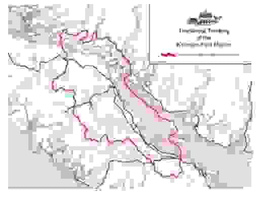
K'omoks First Nation - ʔayʔaǰuθəm Language
The K’omoks First Nation is located in the Comox Valley, with territory from Kelsey Bay to Hornby Island and Denman Island.This image is sourced from K'omoks First Nation Website
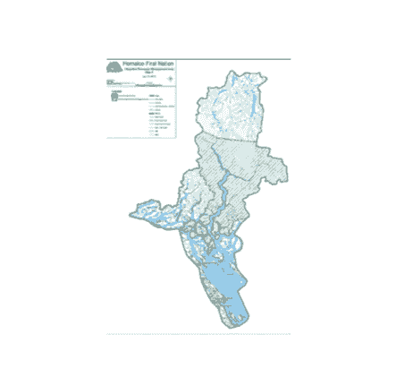
Homalco First Nation - ʔayʔaǰuθəm Language
The Xwémalhkwu or Homalco territory includes all of Bute Inlet and Homathco Ice Fields, extends west to Campbell River on Vancouver Island, south to Comox and north to Sayward, including the Discovery Islands and the Discovery Passage. It extends from Dent Island, slightly west of the mouth of Bute Inlet, to the vicinity of Raza Passage and Toba Inlet.
The image is sourced from Homalco First Nation Website
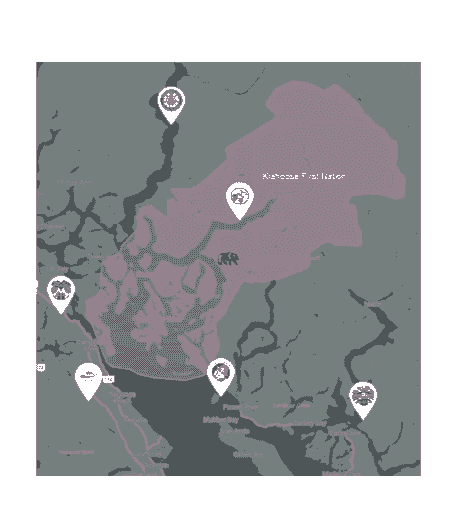
Klahoose First Nation - ʔayʔaǰuθəm Language
Klahoose First Nation territory stretches from Cortes Island to Toba Inlet.
This image is sourced from: Klahoose First Nation Website
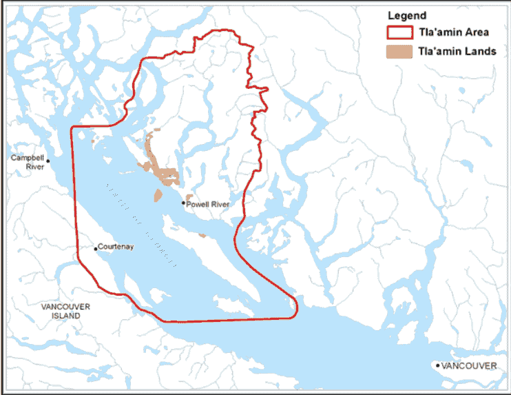
Tla’amin First Nation - ʔayʔaǰuθəm Language
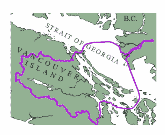
While the Tla’amin Nation is not located on Vancouver Island, their traditional territory spanned both sides of the Georgia Strait.
This image is sourced from a Tla'amin First Nation Website
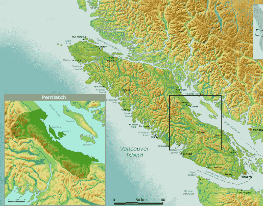
Qualicum First Nation - Pentl'ach Language
The Qualicum First Nation was located near Qualicum Beach and the K’omoks First Nation.
This image is sourced from a website that includes information about the Qualicum First Nation
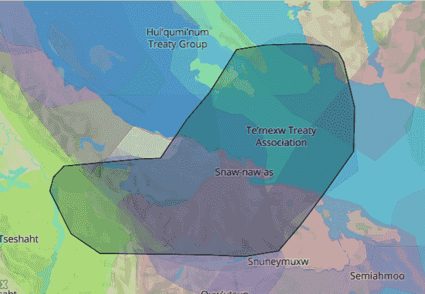
Snaw-naw-as First Nation - Hul'q'umi'num Language
The Snaw-naw-as le lum Nation is located in Nanoose Bay.
This image is sourced from a website that includes information about the Snaw-naw-as First Nation traditional territory
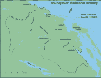
Snuneymuxw First Nation - Hul'q'umi'num Language
The Snuneymuxw First Nation is located in Nanaimo and on Gabriola Island.
This image is sourced from a website that includes information about the Snuneymuxw First Nation
Lake Cowichan, Halalt, Lyackson, Penelakut, Cowichan First Nations - Hul'q'umi'num Language
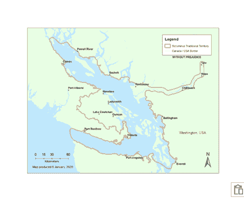
The Lake Cowichan Nation is around Lake Cowichan. The Halalt First Nation is in the lower Chemainus river valley and on Willy Island across from Chemainus, and the Lyackson First Nation’s traditional territory spans from Valdes Island to Chemainus. The Penelakut Nation lives and have traditionally lived on Penelakut Island, Galiano Island, Tent Island and at the mouth of the Chemainus River. The Cowichan First Nation traditional territory spans from the Fraser River to Southern Vancouver Island, the Gulf Islands and Northern Washington State.
Scia’new and Stz’uminus First Nations - Hul'q'umi'num Language
The Scia’new First Nation is in East Sooke at Beecher Bay. The Stz’uminus First Nation’s traditional territory reached from the Strait of Georgia to Ladysmith.
This image is sourced from this site
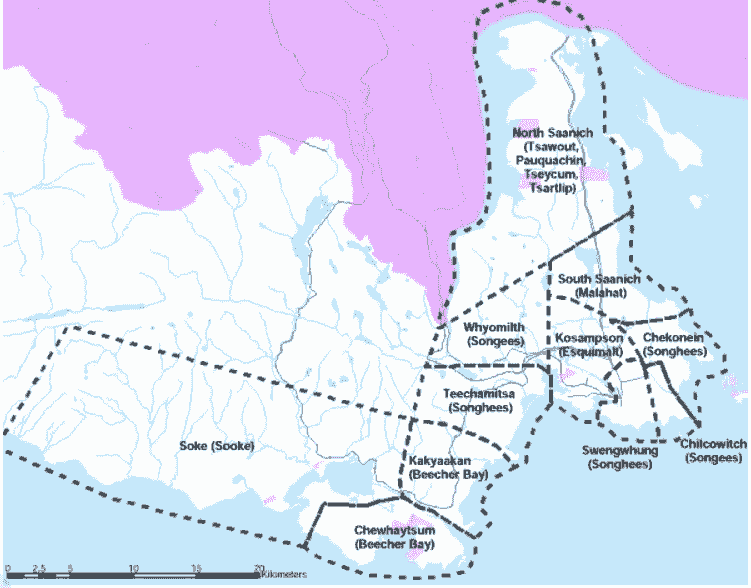
Esquimalt and Songhees First Nations - Lək̓ʷəŋən Language
The Esquimalt people’s traditional territory is in the South Western edge of Victoria and in the town of View Royal, as well as on the Southern portions of Vancouver Island and the lower Gulf and San Juan Islands. Further, the Esquimalt people also went to the Lower Mainland and northwestern Washington State. The Songhees First Nations traditional territory is in Esquimalt and Victoria, specifically at the Inner harbour, James Bay neighborhood and west Victoria.
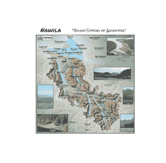
Mamalilikulla-Qwe’qwa’sot’em, Tlowitsis, Da'naxda'xw and Awaetlala, Kwikwasut’inuxw Haxwa’mis, Gwawaenuk, and ʼNa̱mǥis First Nations - Kwak̓wala Language
The Mamalilikulla-Qwe’qwa’sot’em First Nation traditional territory is on Village Island, as well as the Queen Charlotte Strait region. The Tlowits is First Nation was and is located along the Johnson Straight, as well as on Turner Island. The Da'naxda'xwand Awaetlala Nations are both from Knight Inlet, now residing in New Vancouver, on Harbledown Island, as well as in Alert Bay. The Kwikwasut’inuxw Haxwa’mis territory is from Wakeman Sound to Gilford Island and Village Island, and the Gwawaenuk First Nation is located in the Queen Charlotte Strait. ʼNa̱mǥis territory is from the entire Nimpkish and Kokish River Watersheds to several adjacent islands in the Johnstone Strait and Queen Charlotte Strait.
This image is sourced from this Site
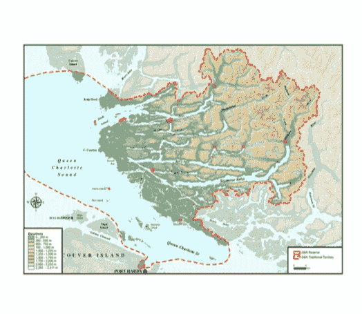
Quatsino, Kwakiutl, Gwa’sala and ‘Nakwaxda’xw First Nations - Kwak̓wala Language
The Quatsino First Nation is located in Quatsino Sound, and the Kwakiutl First Nation territory reaches from Nigei Island to Tyllai Creek, Kipala River and Trinity Bay, as well as Fort Rupert. The Gwa’sala and ‘Nakwaxda’xw are near Port Hardy and Mt. Waddington.
This image is sourced from this Site
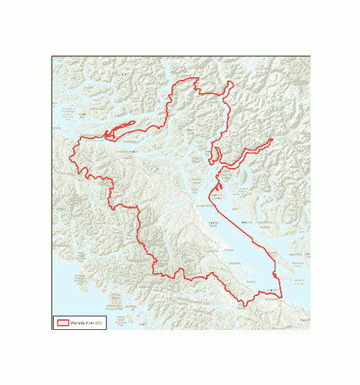
Kwiakah, Wei Wai Kum, Wei Wai Kai, and Tlatlasikwala First Nations - Kwak̓wala Language
The Kwiakah First Nation is in Campbell River, and the Wei Wai Kum traditional territory is from the mouth of
the Nimpkish River to Quadra Island, Knight Inlet, Bute Inlet and across on Vancouver Island, as well as the southern Johnston straits and adjacent mainland inlets, and the Wei Wai Kai First Nation is in Quinsam and on Quadra Island. Finally, the Tlatlasikwala First Nation is located on Bull Harbour on Hope Island.This image is sourced from this Site
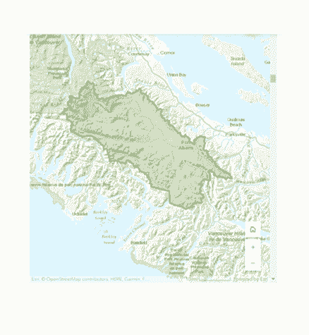
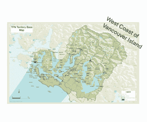
Huu-ay-aht and Hupačasath First Nations - Nuu-chah-nulth Language
The Southern First Nations include the Huu-ay-aht, in the Barkley Sound region, Bamfield and Port Alberni, and the Hupačasath in Port Alberni. This region also includes the Tse-shaht in Port Alberni and Alberni Valley, as well as on Benson Island, and the Uchucklesaht, near Port Alberni and Barkley Sound.
This image is sourced from this Site
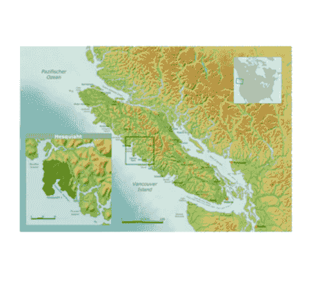
Ahousaht, Hesquiaht, Tla-o-qui-aht, Toquaht, and
Yuu-cluth-aht and Hesquiaht First Nations - Nuu-chah-nulth Language
In the Central region are the Ahousaht, Hesquiaht, Tla-o-qui-aht, Toquaht, and Yuu-cluth-aht First Nations. The Ahousaht are located on the southeastern tip of Flores Island, and the Hesquiaht are located in Hot Springs Cove, Hesquiaht Harbour and Clayoquot Sound.
This image is sourced from this Site
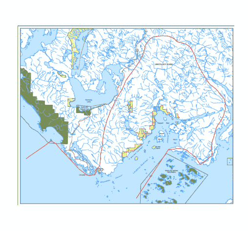
Tla-o-qui-aht First Nation - Nuu-chah-nulth Language
The Tla-o-qui-aht First Nation are on Meares Island, as well as in Tofino and Long Beach and west of Port Alberni.
This image is sourced from this Site
Toquaht and Yuu-cluth-aht First Nations - Nuu-chah-nulth Language
The Toquaht, or T̓uk̓ʷaaʔatḥ, are in Toquaht Bay, Mayne Bay and Western Barkley Sound, as well as Ucluelet and Port Alberni. The Yuu-cluth-aht, or Yuułuʔiłʔatḥ, First Nation is across from Ucluelet, as well as at the northern gateway to Barkley Sound.
This image is sourced from this Site
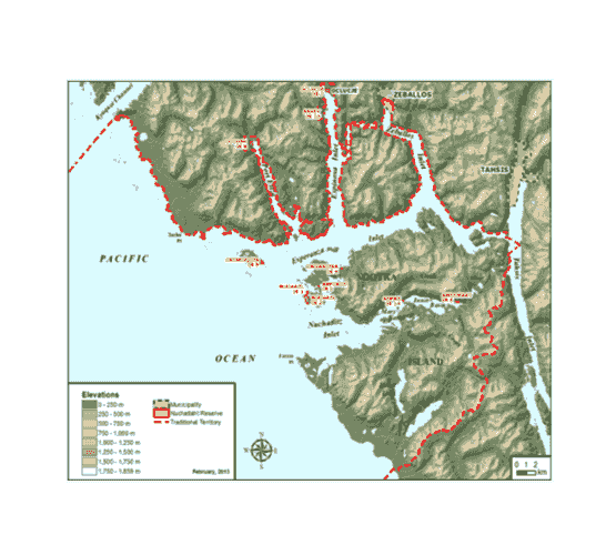
Nuchatlaht, Ehattesaht/chinehkint, Kyuquot/Cheklesaht, and Mowachat/Muchalaht First Nations - Nuu-chah-nulth Language
The northern region Nuu-chah-nulth Nations are Nuchatlaht, Ehattesaht/chinehkint, Kyuquot/Cheklesaht, and Mowachat/Muchalaht. The Nuchatlaht First Nation live on northern Nootka Island and the surrounding inlets, and the Ehattesaht/chinehkint First Nation lives on the Zeballos inlet. The Kyuquot/Cheklesaht, or Ka:’yu:’k’t’h’ / Che:k:tles7et’h’, First Nation are located in Kyuquot and Cheklesaht, and the Mowachat/Muchalaht are located in Yuquot.
This image is sourced from this Site
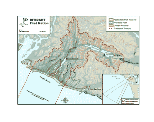
Ditidaht and Pacheedaht First Nations - Diitiidʔaaʔtx̣ Language
The Ditidaht First Nation territory is from the forests surrounding Cowichan Lake to the end of Nitinaht lake, and at the coastline, stretches between Bonilla Point and Pachena Point. The Pacheedaht First Nation territory reaches from Bonilla Point to Sheringham Point.
This image is sourced from this Site


